

I live on the edge of the World. I live in the land of sunsets. And of rainbows. I live on the west slope of the Sierra Nevada, in the foothills of one of the greatest mountain ranges on Earth. Due to the peculiarly unique geology of California, I live at a convergent zone where light, weather and earth can combine in an improvisational dance of heavenly mayhem. The result is an unparalleled display of light, atmosphere, earth and sky.
In the three volumes of Photos from the Edge of the World I have compiled a collection of photos, that I hope have captured the beauty and uniqueness of this special place.
I live on the slopes of Revis Mountain, a minor peak of 2162 feet on the eastern edge of the great Central Valley of California and the western edge of the immense Sierra Nevada. My house is near the head of Long Hollow at an elevation of 1540 ft. Behind it, due east, 8/10s of a mile away, is the summit of Revis Mountain (pronounced reeh-vis ). It is a special peak for two reasons. Number one, is that it is the most significant elevated high point in this section of the Sierra Nevada foothills. Due west is the flat plain of the San Joaquin Valley stretching 80 miles to Pacheco Pass. Secondly, it is a preserved, designated open space and has a well developed trail system along its summit. It is open for recreation to the residents of the exurb surrounding it.
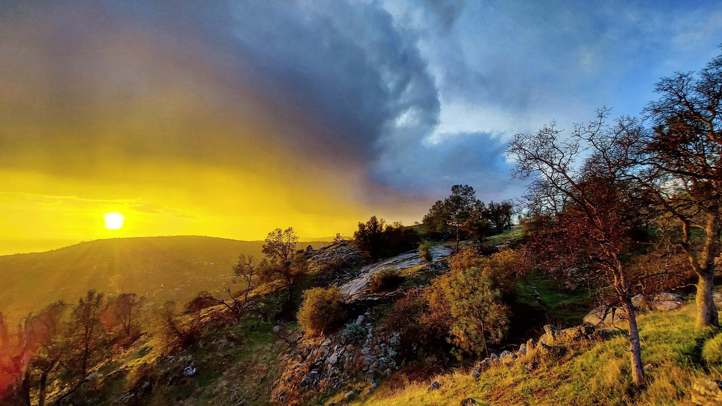
This is where I’ve taken my regular hike for the last 21 months. Along with me I’ve taken my dog Sadie and my phone/camera with me to document the walk. All these photos were taken from late March 2020 to December 2021. They were, almost exclusively, taken on Revis Mountain. I usually hike the trail that undulates along the crest of the mountain. This trail extends for about 1.75 miles one way. I take my walk just before sunset. With a clear, largely unimpeded view to the western horizon, the lighting almost guarantees photogenic landscapes; add some clouds and weather, and it becomes magical.
The trail system on the open space consists of almost 6 miles of established trails and fire roads plus many miles of cross-country options. The trails meander through the Foothill Woodland Zone, a combination of oak savanna, mixed grasslands and a bit of chaparral. This biome forms a transition belt between the grasslands of the Central Valley and the montane zones of the higher elevations of the Sierra. It forms an elliptical ring around the entire Central Valley at an elevation of 300 to 3000 ft. and covers 5 million acres in California; about 5 percent of the state’s landmass.
Blue oaks dominate this landscape along with California buckeye, gray pine and live oak. Manzanita, poison oak and ceanothus are common shrubs. Coyotes, bobcats and rattlesnakes abound; with the occasional black bear or mountain lion wandering through. The climate is Mediterranean, with hot, very dry summers and cool wet winters. Usually, the rainy season begins in late October and November and extends until June some years but most often ends by the end of May. I see very few people on my hike. There are two mountain bikers that I see regularly and the guy with the three dogs (now only two as he had to put the old deaf one down). Occasionally there are teenagers smoking pot at the picnic table at the summit. They don’t realize that if you try to hide the bong on the back seat, that it can be see under the table. It is rare to see any one else.
The hiking season mirrors the Mediterranean winter when the cool rains soften the landscape and make it habitable. It is interior California, after all. The summer is a mind-numbing, sun-filled heat-fest (read John Steinbeck). I wait for the first autumn rains so we can hike the trails again without getting coated with the dried-out brambles, foxtails, burrs, seeds, stickers, stickies, grasses, forbs, prickers, or goats-heads (though ,technically, goats-heads are a year round problem and are only then if you step on them). July, August and September are times this landscape is to be avoided.
Serendipitously, this corresponds with the fire and smoke season and the least interesting weather and sky-scapes. Beginning in October, storms come in from the Pacific, usually sweeping around a low pressure area descending from the Gulf of Alaska. Oddly, these storms start out warm, pulling moisture-laden air in from the south. Occasionally, remnants of a subtropical system sneak up from the Gulf of California and other points south. It is when these storms clear out and/or get hung up on the Sierra and the sun drops below the clouds in the west that the lighting becomes sublime.
Looking from the summit of Revis Mountain, due west, across the sloping ridge of Lilley Mountain (1900 ft.), the vast San Joaquin Valley stretches out to the horizon. One hundred and seventeen miles west, is Monterey Bay and the Pacific Ocean. Eighty-one miles west is the crest of the Diablo Range. Mariposa Peak, Cathedral Peak and Mt. Ararat all top out at over 3200 ft.and define the western horizon. Pyramid-shaped Pacheco Peak is a bit lower at 2769 ft., but is more distinctive and is easily seen in the late afternoon on a clear day. Twice a year the sun sets directly behind the peak. To the southeast, the snow covered peaks of Sequoia and Kings Canyon National Park etch the skyline. From Mt. Brewer at 13,570 ft., in the north, the Great Western Divide stretches 18 miles along the horizon to Sawtooth Peak (12,343 ft.), above Mineral King. This peak, another easily discernible pyramidal shaped mountain, 83.4 miles to the southeast of Revis Mountain, marks the southern end of Sequoia National Park and the beginning of the end of the High Sierra.
On the clearest days, in the clean cold air of a passing winter storm, the Tehachapi Mountains, 165 miles to the south, delineate the southern end of the San Joaquin Valley. They can just be seen floating on the horizon. To the north, the long ridge of Chowchilla Mountain and its high point, Devil Peak (6989 ft.), hide the southern edge of Yosemite National Park and the crest of the High Sierra, 40 miles to the east. Mt. Bullion and the foothills of Mariposa County dominate the views further to the north and northwest.
From the peak of Revis the sun does not appear to set into the pacific. Instead, it sets behind the coast ranges; the Temblor Range in the winter and the Diablo Range in the summer. Pacheco Peak is about the spot where the Temblor Range morphs into the Diablo Range.